Overview
I’m broadly interested in why the surface of the Earth looks the way it does. This has led me in a number of directions. I try to understand the topographic signature of various erosion processes as well as the topographic outcome of tectonic forcing. I am also interested in how chemical weathering affects morphology, and the evolution of coastal ecosystems.
You can have a look at my Google scholar page to see a list of my publications, or navigate to the publications page. Below are some recent papers and projects I’ve been involved in.
Research projects
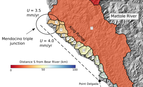
Mendocino triple junction
Hillslopes and channels record a migrating uplift field.
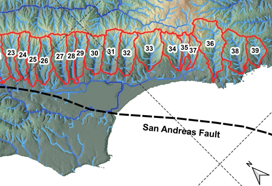
Bolinas Ridge
Tight coupling of hillslopes and rivers along a tectonic gradient.
Knickpoints
Automated detection of knickpoints based on channel segmentation.
Marsh elevations
Marsh platform topography indicates the importantce of storms and spring tides in maintaing marsh elevations.